
Submitted by Edward Geary
The introduction of the Emery County Public Land Management Act of 2018, under the sponsorship of Senator Orrin Hatch and Representative John Curtis, is an event that citizens of Emery County have been looking forward to, and working to bring about, for more than two decades. The proposed bill represents 23 years of concentrated efforts by Emery County officials and the citizen-based Emery County Public Lands Council to develop a comprehensive plan that will protect and preserve the county’s most spectacular and pristine areas while also preserving the county’s ranching heritage, sustaining local economic development and allowing recreational access to these remarkable lands.
The Federal Land Policy and Management Act of 1976 gave the Interior Department 15 years to complete an inventory of public lands that met the qualifications for wilderness protection. These lands were then provided temporary protection as Wilderness Study Areas with the expectation that Congress would act promptly to either designate the lands as wilderness or else return them to multiple use management. More than 40 years later, the “temporary” WSA status is still in place in Emery County, leaving both the county residents and the local BLM officials in uncertainty as to the eventual designation or non-designation of the land and the ultimate status of existing roads, grazing, mineral development and recreational opportunities.
The responsibility for developing a comprehensive plan was assigned to the Emery County Public Lands Council, a group of citizen volunteers representing a variety of interests and backgrounds and appointed to advise the Emery County Commission and the Public Lands Administrator. The PLC adopted some principles to guide their work. First, this was to be an open process with various stakeholders, both within and outside of the county, invited to enter into the discussion. Second, decisions would be based on a close, on-the-ground study. Wilderness boundaries were to follow visible landscape features such as roads, cliff bases or canyon rims in order to enable effective management. Third, every decision should be subjected to the standard of common-sense reasoning rather than a particular ideological position.
Numerous stakeholder groups and individuals, including conservation organizations, livestock and mineral development interests, wildlife organizations, motorized and non-motorized recreation groups, congressional staffers, and state officials responded to the invitation to participate. Countless hours and thousands of miles were spent in on-the-ground visits to every section of a county that is larger than some states. Updated maps and discussion points were published on the county public lands website, and several open meetings were convened to gather public comments.
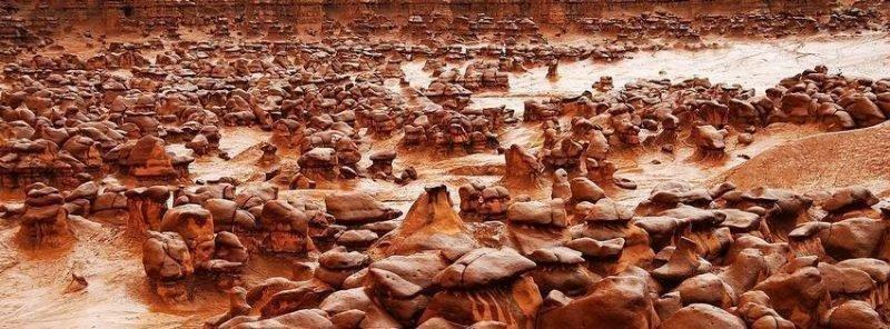
The resulting Emery County Public Land Management Act of 2018 represents one of most important developments in public lands legislation in recent history. This act, when the exchanges of state trust lands are completed, will create 577,986 acres of permanent, congressionally designated wilderness, plus an additional 383,380 acres in the San Rafael Swell Western Heritage and Historic Mining National Conservation Area, 2,543 acres in the Jurassic National Monument, and 9,350 acres to an expanded Goblin Valley Utah State Park, for a total of 973,259 acres of conservation land. These conservation areas will have permanent protection from new roads, mining, drilling and other forms of development. At the same time, traditional public access will be preserved through existing roads and trails, and existing grazing, hunting, hiking, rafting, climbing and other outdoor activities will continue. The remaining public lands of Emery County will continue in multiple-use management, vitally important to the health of a rural natural resource economy.
The proposed wilderness designation represents an increase of 146,000 acres beyond present Wilderness Study Areas in Emery County. Most of the increase goes to an enlarged Desolation Canyon Wilderness, which will preserve one of the most pristine roadless areas in the nation. In addition, the only two sizeable roadless areas in the Manti-LaSal National Forest in Emery County, Candland Mountain and Nelson Mountain, are also proposed for wilderness status.
One conservation organization that was invited to participate in the discussions, but chose to disengage at an early stage, has recently launched an ad campaign against the legislation. They claim that the Emery County Act does not do enough to protect wilderness-quality lands. But one wonders what would be “enough” to satisfy this uncompromising organization. The Emery County bill will give permanent protection to more than one-third of the county’s land through wilderness or National Conservation Area designation. Now, they are demanding an additional 900,000 acres, or two-thirds of the land, which would devastate an already suffering rural economy and destroy a heritage that has tied a people to a landscape for 150 years.
Even Wallace Stegner, the great champion of wilderness, acknowledged the value of that heritage in his description of Emery County and adjacent areas in American Places (1983). He wrote: “The plateaus remain aloof and almost uninhabited, but the valleys are a collaboration between land and people, and each has changed the other.” Then he added, “The land is not complete without its human history and associations. Scenery by itself is pretty sterile.”
The Emery County lands bill represents our best effort to balance the preservation of our pristine landscapes with the preservation of our rural communities that depend on the wise use of our natural resources, the scarce water, and grazing land, and farms, and mineral resources that provide a living for our families. We encourage all Utahns who share these values to join in support of the Emery County Public Land Management Act of 2018.