
By Ray Petersen
Recent Modifications to HR 5727, S 2908
The Emery County Land Use Bill has generally retained the same elements since the Public Lands Council (PLC) made its recommendation to County Commissioners nearly six years ago. It will be helpful, I’m sure, to explain some modifications which have taken place.
The basic footprint of the Wilderness Study Areas was slightly increased (less than ten percent) for proposed wilderness designation. Proposed Wild and Scenic River designation was reduced somewhat to avoid potential conflict with the Ute Indian Tribe. During Congressman Rob Bishop’s effort to pass his Public Lands Initiative (PLI), the concept of designating the Cleveland Lloyd Dinosaur Quarry as a National Monument was conceived. Livestock grazing permittees rode the range with GPS technology and proposed a boundary, which includes just over 2,500 acres within the National Monument and will not impact grazing operations.
Initially, several options were considered by the PLC for the interior of the Swell, inside the oval shaped ring of wilderness designation. The concept was to create a designation, which would allow for protection and interpretation of western heritage and historic mining resources but not be overly restrictive to visitation and enjoyment by the public. Considerations included National Recreation Area, National Conservation Area, National Park, Historic Mining District and probably others that I have forgotten. National Conservation Area (NCA) seemed to fit best and was included in the legislative language up until recently. Although the NCA concept generally was a good fit, the existing roads and trails in the area were a major sticking point with some members of congress. Some legislators are of the opinion that the existing motorized access is not consistent with “conservation.” The county representatives and Washington delegation staff members wrestled with this issue for some time. Cherry-stemming, corridor width definitions and grandfathering of the BLM Travel Plan are some of strategies which have been considered, as well as various designations, including National Recreation Area. As the deadline for this article approaches, there is some uncertainty as to which strategy and terminology is best.
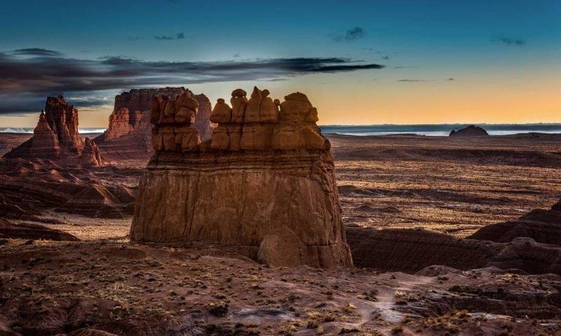
Expansion of Goblin Valley State Park was not included in the original concept in 2012. During the period when PLI was developing, the Division of State Parks and Recreation was invited to propose areas which would be desirable for either establishing new parks or expanding existing facilities. Several iterations in the Goblin Valley area followed, including a proposal which included much of McKay Flat, Red’s Canyon, Lucky Strike and the Hondu areas. Much discussion and brainstorming has followed, and recent modification of the State Park expansion proposal includes about 10,000 acres, including the corridor along the “front” side of the reef from Ding and Dang Canyon to the Temple Wash and Temple Mountain area.
Apart from designation changes which involved changes to the map, statements and language in the text of the bill has also evolved. Some of the language which was included initially has been edited. Some has been deleted. For example, originally the bill called for designating a trail west of the communities from the Hiawatha vicinity to south of Emery. It was determined that such a trail could be created within the parameters of the current BLM management plan and would not require Congressional designation. Also, some references to existing federal laws were determined unnecessary since the legislation proposes no change to existing law.
One final statement is appropriate, and though I mentioned it in an earlier article, it will be helpful to reiterate because it has to do with motorized routes in the areas designated in this legislation. The settlement agreement issued in January of 2017 as a result of the SUWA vs. Department of the Interior litigation will be carried out. Travel Management completed by Price BLM will ultimately determine what motorized routes are open in the San Rafael Swell Travel Management Area and San Rafael Desert Travel Management Area. The settlement agreement was signed by Utah BLM, Earthjustice, Southern Utah Wilderness Association, and motorized recreation advocates: Blue Ribbon Coalition, Colorado Off-highway Vehicle Coalition and Trails Preservation Alliance.
It is anticipated that further action in the House and Senate is forthcoming.